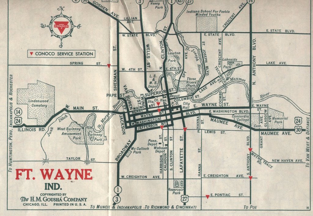
This is my oldest dated roadmap of Fort Wayne. I have a number of others from years in between then and now. Unfortunately, they are not Gousha maps and lack the detail that you see here. Note the not so politically correct name for Park Center on State Street (Barely within the city limits in that era) : "Indiana School for Feeble-Minded Youths".
If you were "of means", you could purchase one of the stately new homes going up along Rudisill Boulevard in the new "suburbs". If you were traveling through town on US 30 or US 24, you'd need to pay close attention to the signs as several turns and street changes were involved!
A trip to Indianapolis was quite an adventure as well. Both of the usual routes taken involved over 100 miles of two-lane blacktop (at best) that ran through every town imaginable along the way. It would remain that way for nearly thirty more years. . .
3 comments:
So the city's road layout was screwed up even then...
Actually, the entire country's. . .Imagine a trip to California! But, then again, it beat the muddy rutted trails that were the only routes prior to those snaking two-lane roads. . .
My grandparents lived across the street from the "feeble-minded youth" home. I have heard stories about my grandmother coming into the living room and finding one those youth sitting in a chair watching TV. I can remember as a young child seeing the phone number to the old "State school" taped to the inside of the cabinet next to the phone. They would simply call the school and a staff member would come retrieve the patient. After of course my grandmothe would feed them some of her famous banana bread. I think that's why the ykept coming back. LOL
Post a Comment